Every farm in Gujarat is now part of a digital record. Under this initiative, a trained surveyor walks to your plot, opens a GPS-linked app, and records what you grow. That single data point drives crop insurance claims, government subsidies, and procurement planning | directly and without paperwork. This guide covers everything: the background, the process, the app, and what it means for farmers.
What Is the Digital Crop Survey?
The DCS is India's replacement for the old manual Girdawari system. Girdawari was a paper-based crop recording process run by Patwaris. It was slow, prone to errors, and easy to manipulate. Data often reached state offices weeks after the season ended.
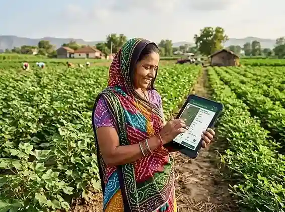
This fixes the problem at the source. A government-selected surveyor visits each agricultural plot in a village. Using a mobile app with a live cadastral map, they record the crop name, area under cultivation, and irrigation type | then submit it in real time. The data flows straight into the national AgriStack database.
The Ministry of Agriculture and Farmers' Welfare launched this under the Digital Agriculture Mission, which has a total budget of Rs 2,817 crore. The mission aims to build a Digital Public Infrastructure (DPI) for Indian agriculture | much like Aadhaar did for identity.
Gujarat was part of the pilot in 2023-24, with Gandhinagar district as the initial test zone. The state scaled to full district coverage by Kharif 2024. Gujarat's crop data from that season was used directly in India's First Advance Estimates of food grain production | a national first.
Why the Old Girdawari System Failed
To understand the DCS, it helps to understand what came before it. The Girdawari system had been in use for over a century. A Patwari would walk through fields and note crop details by hand. The records were transcribed to paper registers, then sent to district offices, then to the state, then to the centre.
This process had serious problems. Manual entries were often wrong or delayed. Some Patwaris covered hundreds of plots alone | making thorough field visits nearly impossible. Crop area data could be inflated or understated, distorting subsidy calculations and insurance claims.
The Centre acknowledged this clearly. The Economics, Statistics and Evaluation Division (ESED) under the Ministry of Agriculture stated that existing production estimates were "completely manual" and resulted in "delay and manual errors." That acknowledgement drove the shift to the digital system.
Gujarat, like most states, relied entirely on this manual process until the DCS rollout. The state now has a system that produces plot-level, GPS-verified, time-stamped crop records | visible to state authorities and the Centre in near real time.
How the Survey Process Works in Gujarat
The operation runs as a structured field process. Here is the step-by-step process as it works in Gujarat today.
-
1
Surveyor selection at village level
The state government appoints one surveyor per village. These are often educated local residents, retired government staff, or trained field workers. They are not necessarily Patwaris. For the Rabi 2024-25 survey, Gujarat deployed surveyors across all 18,464 revenue villages starting December 15, 2024.
-
2
Surveyor gets access to the app
Each surveyor is assigned login credentials for the DCS Gujarat app (available on Google Play, package ID: com.gujarat.agristack). The app loads a geo-referenced cadastral map showing all plots in the assigned village. Each plot has a unique survey number.
-
3
Field visit with GPS confirmation
The surveyor walks to each plot. The app confirms that the device is physically at that location using GPS. This prevents remote or desk-based data entry | the surveyor must be present at the actual plot boundary.
-
4
Crop data entry
At each plot, the surveyor selects: the crop currently grown (from a standardized list), whether the land is irrigated or rain-fed, and whether any portion is fallow. For mixed cropping, both crops are recorded. Agricultural and non-agricultural plot data are both captured.
-
5
Photo and submission
Some plot entries require a geo-tagged photograph of the standing crop. After entry, the surveyor submits the record. It uploads to the state server immediately if connectivity is available, or syncs when the device comes online.
-
6
Data validation and aggregation
Submitted records go through automated validation checks. Village-level aggregated data is compiled and shared with the Department of Agriculture and Farmers' Welfare (DA&FW) at the Centre via API. This powers national crop production estimates.
Crops Recorded in Gujarat Each Season
Gujarat grows a diverse mix of Kharif and Rabi crops. The survey captures data for all of them. Understanding which crops are surveyed tells you how the data feeds into different scheme calculations.
Kharif crops (June to October)
The Kharif season is Gujarat's primary sowing period. Monsoon rains determine what farmers plant. The DCS records data for:
- Groundnut | Gujarat's largest crop by area, often exceeding 20 lakh hectares in a good year
- Cotton | a major cash crop across north and central Gujarat
- Paddy | concentrated in south Gujarat, especially Valsad, Navsari, and Surat districts
- Bajra (Pearl Millet) | grown widely in Surendranagar, Banaskantha, and Patan
- Maize | primarily in Panchmahal, Dahod, and Chhota Udaipur
- Sesame, Castor, Soybean | oilseeds recorded across multiple districts
- Vegetables and horticulture crops | including potato, onion, and banana in relevant zones
Rabi crops (November to March)
The Rabi survey captures winter crop data. Key crops include:
- Wheat | grown in north Gujarat and Saurashtra
- Mustard (Rapeseed) | oilseed crop in Banaskantha and Patan
- Cumin (Jeera) | Gujarat produces a large share of India's cumin, concentrated in Banaskantha
- Chickpea (Chana) | winter pulse crop across Saurashtra and north Gujarat
- Fennel (Saunf), Isabgol, Ajwain | specialty crops in specific belt areas
- Fallow land | plots not under any crop are also recorded, which helps plan irrigation and input supply
| Season | Survey Period | Key Crops Covered | Survey Duration |
|---|---|---|---|
| Kharif 2024-25 | July – October 2024 | Groundnut, Cotton, Paddy, Bajra, Maize | Completed Oct 25, 2024 |
| Rabi 2024-25 | Dec 15, 2024 – Jan 2025 | Wheat, Mustard, Cumin, Chickpea | 45 days |
| Kharif 2025-26 | July – October 2025 | All Kharif crops, 33 districts | ~120 days |
| Rabi 2025-26 | December 2025 onwards | All Rabi crops, 18,464 villages | 45 days |
AgriStack Gujarat and the Farmer ID Connection
This scheme does not work alone. It is one layer inside a larger system called AgriStack | India's agricultural digital public infrastructure. Understanding the connection helps farmers see why registration matters.
AgriStack has three main pillars:
- Farmer Registry | a unique Farmer ID (like Aadhaar for agriculture) linked to land records, bank account, and Aadhaar
- Crop Sown Registry | plot-level crop data collected through the DCS, linked to the Farmer ID
- Geo-referenced Village Maps | cadastral maps digitized and linked to each plot's survey number
When these three connect, the government knows exactly who grows what, on which plot, in which season. That data powers targeted scheme delivery. A farmer with a registered Farmer ID and verified crop data does not need to submit forms for schemes like PM Fasal Bima Yojana | the system can auto-enroll them based on their crop record.
The National Informatics Centre (NIC) manages the AgriStack Gujarat platform. Farmers can register at the official portal or through a Common Service Centre (CSC). The Gujarat AgriStack portal is at dcsagristack.gujarat.gov.in. The national portal is at asdcs.agristack.gov.in.
What This Survey Means for Gujarat Farmers
The survey is a government data exercise | but its impact lands directly with farmers. Here is how the data from your plot translates into real benefits.
Faster crop insurance claims
Your DCS record is the baseline for PM Fasal Bima Yojana (PMFBY) damage assessment. When a natural disaster hits, insurers cross-check your claim against the DCS record. A verified digital entry speeds up settlement and reduces disputes over what crop was actually grown.
MSP-based procurement access
Minimum Support Price (MSP) procurement is targeted at verified growers. When your plot shows a recorded crop in the DCS, procurement agencies can identify you as an eligible seller. This is especially relevant for cotton and groundnut in Gujarat's major producing districts.
Direct subsidy transfers
Input subsidies for seeds, fertilizers, and irrigation equipment are increasingly routed through Direct Benefit Transfer (DBT). Your DCS data, linked to your Farmer ID and Aadhaar, enables the system to push subsidies straight to your bank account without middlemen.
Kisan Credit Card and crop loans
Banks use crop sown records to assess loan eligibility and limits. A verified DCS entry serves as proof of cultivation for Kisan Credit Card (KCC) applications. Loan processing time drops when your crop record is already in the system.
Accurate production planning
State and central agencies use DCS data to plan cold storage allocation, mandi arrivals, and market price support. Farmers in districts with high groundnut or cumin coverage benefit when procurement and infrastructure are sized correctly for that season's output.
Reduced fraud in scheme delivery
GPS-verified records make it harder to claim benefits for plots that do not have a matching crop entry. This protects genuine farmers from being crowded out by inflated claims or duplicate entries | a real problem under the old paper-based system.
How the DCS Connects to PM Fasal Bima Yojana
The link between the DCS and PM Fasal Bima Yojana (PMFBY) is one of the most important things Gujarat farmers need to understand. These two systems now work together.
PMFBY is India's main crop insurance scheme. Farmers pay a small premium | 2% for Kharif food and oilseed crops, 1.5% for Rabi, and 5% for commercial and horticultural crops. The government subsidizes the rest. When crops fail due to floods, drought, unseasonal rain, or pest attacks, farmers get compensation.
The problem under the old system was verification. Did the farmer actually grow what they claimed? How much area? Was the damage real? These questions caused delays and disputes. The DCS changes the starting point. Before any damage occurs, the survey creates a ground-truth record of exactly what each plot was growing. When a claim comes in, insurers compare it against that record.
Gujarat is one of four states | along with Uttar Pradesh, Madhya Pradesh, and Odisha | where the government has used DCS-based estimates in national crop production figures. That means Gujarat's crop insurance calculations are now backed by plot-level digital data, not aggregated estimates.
Note: Gujarat farmers enroll in PMFBY through the state's own portal, not the national NCIP portal. The official PMFBY site notes that Gujarat manages enrollment separately. For current-season enrollment, visit the Gujarat agriculture department's website or your nearest Common Service Centre.
How to Check Your Crop Survey Data Online
Gujarat farmers can verify their own plot data through the AgriStack portal. Here is how to do it.
-
1
Go to the Gujarat DCS portal
Visit dcsagristack.gujarat.gov.in. This is the state-level portal for crop survey data in Gujarat. The national portal at asdcs.agristack.gov.in also provides data access.
-
2
Log in with your Farmer ID or mobile number
Use the mobile number linked to your AgriStack Farmer ID to log in. If you have not registered for a Farmer ID yet, you can still search plot data using your village name and survey number (khata/plot number).
-
3
Select district, taluka, and village
Navigate to your district, then taluka, then village. Enter your plot survey number. The system will show what crop was recorded for that plot in the most recent survey season.
-
4
Raise a correction if data is wrong
If the crop recorded is incorrect | for example, the surveyor marked the wrong crop or left your plot blank | contact your village surveyor or the local Talati (village accountant). Corrections must be submitted before the survey window closes for that season.
District-wise Scope: 33 Districts, 18,464 Villages
The survey in Gujarat covers the entire state | no district or village is excluded from the scope. This is different from many states where DCS coverage is partial.
| Region | Key Districts | Primary Kharif Crop | Primary Rabi Crop |
|---|---|---|---|
| Saurashtra | Rajkot, Junagadh, Amreli, Bhavnagar, Porbandar | Groundnut, Cotton | Wheat, Chickpea |
| North Gujarat | Banaskantha, Patan, Mehsana, Sabarkantha | Bajra, Cotton | Cumin, Mustard, Fennel |
| Central Gujarat | Anand, Kheda, Vadodara, Nadiad | Paddy, Tobacco, Maize | Wheat, Mustard |
| South Gujarat | Surat, Navsari, Valsad, Bharuch, Narmada | Paddy, Sugarcane | Wheat, Chickpea |
| Tribal Belt | Dahod, Panchmahal, Chhota Udaipur, Tapi | Maize, Paddy, Bajra | Wheat, Vegetables |
| Kutch | Kutch district (single large district) | Cotton, Bajra | Wheat, Castor |
Each region has different cropping patterns. The DCS captures this diversity at the plot level. For Gujarat's specialty crops | cumin in Banaskantha, Isabgol in Unjha, fennel in Mehsana | the digital record creates a first-ever systematic dataset. This data informs export planning and commodity market operations in ways the old system could never support.
Technology Behind the Survey: GPS, GIS, and AI
This system is not just a data entry exercise. It uses several layers of technology that improve both accuracy and usability.
GPS-enabled cadastral maps
Every farm plot in Gujarat has been digitized from revenue records. These plots are mapped with GPS coordinates and loaded into the survey app. The surveyor's device must be within a defined radius of the plot to submit a record. This GPS-locking feature prevents false entries from remote locations.
Remote sensing and satellite validation
The state and central governments use satellite imagery to cross-check ground-level survey data. If a plot's DCS entry shows cotton but satellite crop classification shows a different landcover, the record is flagged for review. This dual-source validation significantly reduces fraud and error.
Integration with Krishi Decision Support System (Krishi-DSS)
The DCS feeds into the Krishi Decision Support System, a national geospatial platform launched in 2024. Krishi-DSS integrates soil data, weather forecasts, groundwater levels, and satellite imagery alongside crop survey records. State officials use it to identify stress zones, plan input supply, and target relief operations.
AI-assisted crop classification
The Digital Agriculture Mission uses AI models trained on satellite and field data to assist in crop identification. When a surveyor submits a crop entry, the system can compare it against AI-predicted crop types from imagery. Mismatches prompt a secondary review, improving final data quality.
API-based data sharing
Gujarat shares village-level aggregated crop data with the Centre through a standardized API. This direct machine-to-machine transfer replaces the old process of printed reports and manual uploads. The Centre receives accurate state estimates within days of the survey window closing.
How Gujarat Farmers Register on AgriStack
The DCS covers your plot automatically through the surveyor. But getting a Farmer ID on AgriStack connects your crop data to your identity | and unlocks scheme benefits. Here is how Gujarat farmers register.
-
1
Visit a Common Service Centre (CSC) or the AgriStack portal
Go to your nearest CSC or open the AgriStack Gujarat portal. CSC operators are trained to help with registration. The portal at dcsagristack.gujarat.gov.in has a farmer registration section.
-
2
Provide basic documents
You need your Aadhaar card, mobile number linked to Aadhaar, land record details (7/12 extract or Satbara Utara), and bank account number. The system links these to your Farmer ID.
-
3
Verify with OTP
An OTP is sent to your Aadhaar-linked mobile number. After verification, your Farmer ID is generated. This ID is unique to you across all government agriculture schemes.
-
4
Land records are linked automatically
After registration, your land record data from the Gujarat revenue department is linked to your Farmer ID. Your DCS crop data | recorded by the village surveyor | then automatically attaches to your profile each season.
As of early 2026, the government has created over 7.63 crore Farmer IDs nationally, with Gujarat contributing a significant share. Farmers who registered early have already seen benefits in PMFBY enrollment and PM-KISAN payment verification.
Practical Challenges and What the Government Is Doing
This system is a major improvement, but implementation is not without problems. Knowing the challenges helps farmers respond if their data is missing or incorrect.
Connectivity in remote villages
Some villages in Kutch, the tribal belt of Dahod and Panchmahal, and coastal areas have weak mobile data coverage. The survey app has an offline mode | surveyors can enter data without a live connection and sync when they reach a covered area. But if syncing fails, records can be lost or delayed. The government is expanding mobile coverage in these zones under separate Digital India programs.
Surveyor workload in large villages
A single surveyor assigned to a large village may have hundreds of plots to cover in a fixed time window. If the surveyor rushes, some entries may be incomplete or incorrectly classified. Farmers should verify their plot data on the portal after the survey window and report errors promptly.
Geo-referenced map gaps
Not all cadastral maps were fully digitized when the DCS launched. Some older revenue records had measurement errors or boundary overlaps. The Gujarat revenue department is updating these records under the SVAMITVA scheme and Digital India Land Records Modernisation Programme (DILRMP). Farmers with boundary disputes may find their plot data incomplete until those records are resolved.
Farmer awareness
Many small and marginal farmers in Gujarat do not know the DCS exists or what it means for their schemes. The government is running awareness programs through Krishi Vigyan Kendras (KVKs), district agriculture officers, and gram sabhas. Farmers who do not know their Farmer ID or survey number are at a disadvantage when claiming benefits.